Skip to product information
1 of 7

Muir Way

North America 1965 Shaded Relief Map

North America 1965 Shaded Relief Map

5.0
Rated 5.0 out of 5 stars
23 Reviews
Regular price $99.00 USD
Regular price Sale price $99.00 USD
Sale Sold out
Shipping calculated at checkout.
Fine Art Paper – Flat 2D Print
Frame

We created this map with the illusion of 3D by applying Digital Elevation Data and meticulously adding shaded relief to the landscape of the original 1965 North America Geological map. The shading is printed on the paper and not a result of the map protruding from the surface.

Please Note: Text on the map can be difficult to read due to the small font size and the age of the map. In areas where the relief shading covers the text, the underlying text is not legible. We suggest the largest size map for better details though the text may still be covered in the darker areas.

Shipping and Returns

FREE SHIPPING on domestic orders over $49 with UPS ground or USPS to PO Boxes.

  • Paper prints ship within 1-2 business days plus transit time.
  • Framed Prints ship within 2-3 weeks plus transit time.

Full refund on returns within 30 days of purchase on unframed paper prints. We do NOT ACCEPT returns or exchanges on framed prints or canvas wraps because they are made to order.

Click HERE for more information on shipping and returns

American Hardwood Frames

We use real Walnut for our frames, unlike the lesser quality veneer you will typically find elsewhere. With beautiful hardwood grain, each is handmade to order at a professional frame shop.

  • 7/8 inch face and 1 1/2 inch depth
  • Acrylite glazing (clearer than glass)
  • Acid-free backing paper
  • Hanging wire installed

Gallery Quality

Made in the USA

We consider our maps to be works of art, so we print and frame them accordingly.

Using award-winning printers with gallery quality fine art paper and inks, our maps will exceed expectations and last a lifetime.

  • Archival Paper and Inks
  • 100% Cotton, OBA-Free, and Acid-Free
  • Heavyweight 21.5 mil
  • Certified to last 100 years

Read customer reviews HERE attesting to the quality of our prints.

View full details
5.0
Rated 5.0 out of 5 stars
Based on 23 reviews
Total 5 star reviews: 22 Total 4 star reviews: 1 Total 3 star reviews: 0 Total 2 star reviews: 0 Total 1 star reviews: 0
100%would recommend this product
Customer-uploaded media carousel. Press left and right arrows to navigate. Press space or enter to open more details.
Slide 1 selected
23 reviews
  • JH
    Jane H.
    Verified Buyer
    I recommend this product
    Age Range 65+
    I bought this As a gift
    Rated 5 out of 5 stars
    1 year ago
    North America 1965 Shaded Relief Map

    My grandson, Eli, loved his new map and will be putting it above his desk. He just turned 7-years-old and is very inquisitive.

  • SJ
    Susan J.
    Verified Buyer
    I recommend this product
    Age Range 55 - 64
    I bought this For myself
    Rated 5 out of 5 stars
    1 year ago
    Love it!

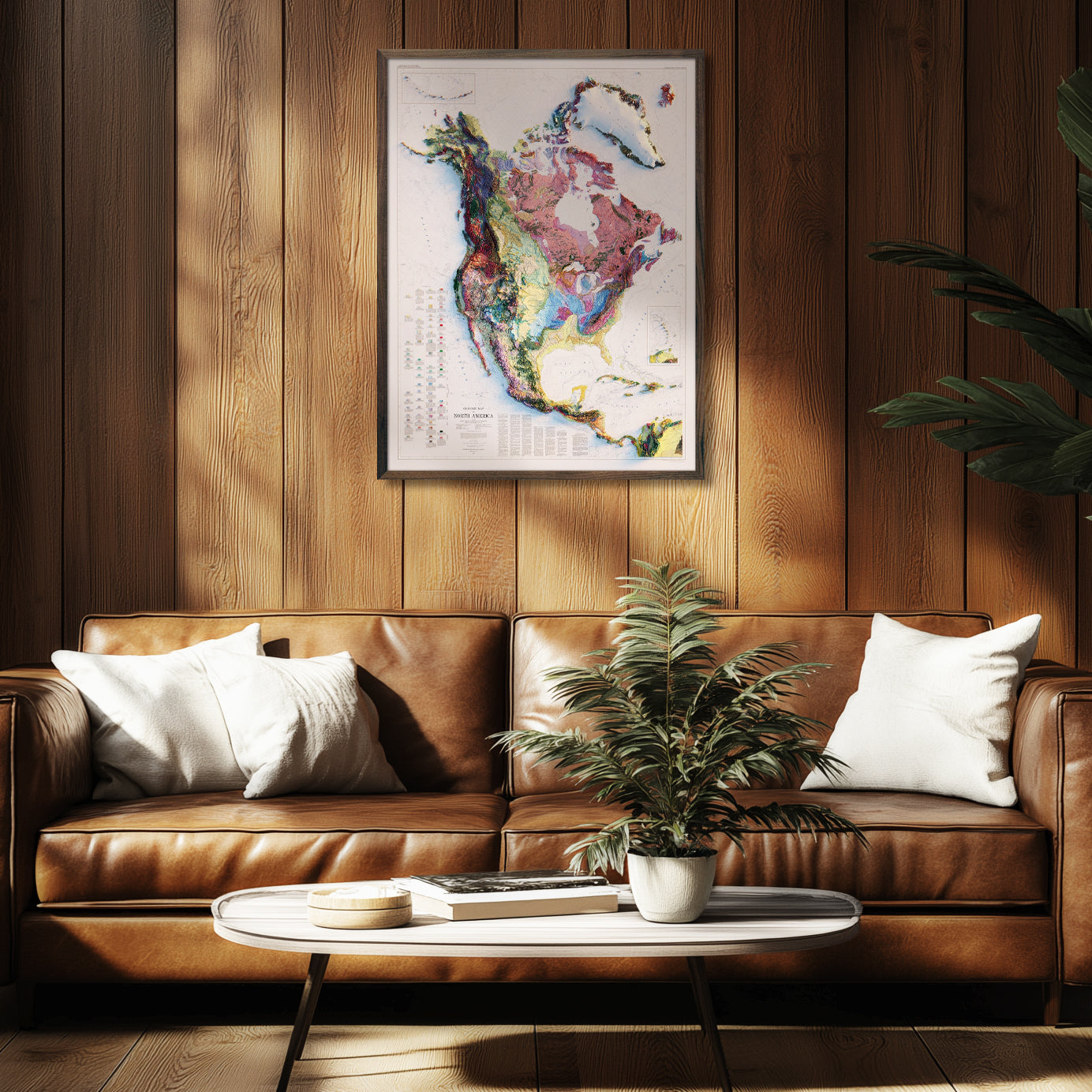
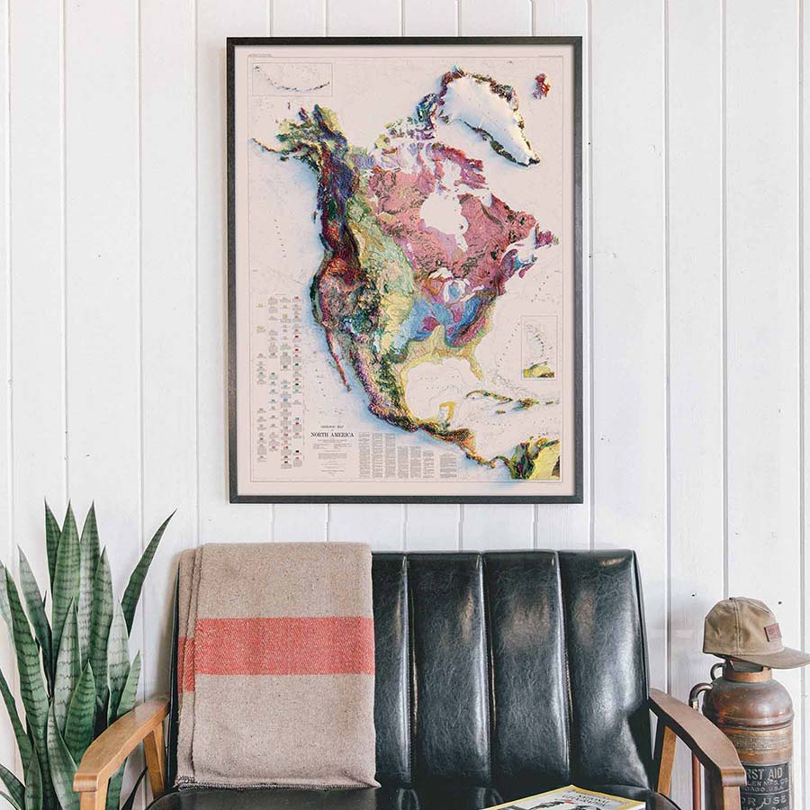
    I absolutely love the North America relief map!

    I knew it would look gorgeous on my wall, and it does! Great color and detail, very vibrant!

  • PT Profile picture for Persian T.google logo
    Persian T.
    Verified Buyer
    I recommend this product
    Age Range 25 - 34
    I bought this For myself
    Rated 5 out of 5 stars
    2 years ago
    Very impressed

    I’ve become obsessed with the color relief maps. They are so incredibly impressive (my personal favs are the maps of the continents). I’ve never seen anything better.

  • TF
    Trent F.
    Verified Buyer
    I recommend this product
    Age Range 55 - 64
    Rated 5 out of 5 stars
    9 months ago
    Beautiful Map

    I love the map and I’m looking forward to placing it the Christmas moon area of my cafe in Alaska! Great color and detail. I’m looking forward to people enjoying it for years to come😊

  • RC
    Richard C.
    Verified Buyer
    I recommend this product
    Age Range 65+
    I bought this For myself
    Rated 5 out of 5 stars
    1 year ago
    Wonderful

    I got the West Coast map. It was great (expensive frame), until I saw the US map . I got that one also (made my own frame) but missed the upper and lower regions (Canada and Mexico). The North America map has it all ( gave up on a frame, hanging from clips on a line), but each of the other maps has more detail because they focus on a smaller area. I got the largest size of all of them. They adorn major parts of my walls. So much info, so visual, so cool

Reviews LoadedReviews Added